Ankerplatz · Bahamas
West End
Grand Bahama, Bahamas
Position 26°41′ N 078°58′ W
5 Folgen, hier gefilmt von 2 Crews
Teil vonAtlantic Intracoastal Waterway (von Norfolk bis Florida)
Hier gefilmt 5
-

Fast Sail to West End, Grand Bahamas From Mangrove Cay | Last Stop Before Crossing the Gulf Stream
At dawn, I raise anchor and set sail aboard Mirage for a 40+ mile solo passage to West End, Bahamas - the northernmost inhabited point of the Bahamian islands and my last stop before crossing the Gulf Stream.
-
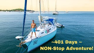
401 Days (Part 1) Sailing & Exploring USA & Bahamas
The is the beginning of a very big story! The longest time I've consecutively sailed and cruised. The longest time I've lived at anchor, the most fish I've spearfished and eaten.
-

Sailing & Checking Into the Bahamas (Day #1) West End
Thiago and I had set sail from Fort Lauderdale Florida the night before. After 12hrs sailing fast, and a bit more North than I'd have liked. We made it to our second choice of a destination in the Bahamas.
-
Found A SUNK Sailboat!!! 1st Day In The Bahamas - Ep #4 (life on a sailboat)
In this episode Maru and I sail out from West End. Seeking a good place to anchor and truly begin living the cruising lifestyle here in the Bahamas. But along the way we happen..... I mean nearly hit an unmarked sunk sailboat!!!
-
Sailing USA to the Bahamas!!! - West Palm Beach to West End EP -3 (Living on a sailboat)
Important links for checking into the Bahamas: (Must be filled out & approved prior to checking into the Bahamas) P.S. If you have proof of COVID vaccines you don't need to do this.
Crews, die hier gefilmt haben
Häfen in der Nähe
- Ginn Sur MerBahamas0 sm WSW
- Grand Lucaya WaterwayBahamas21 sm OSO
- Grand LucayaBahamas21 sm OSO
- Grand BahamaBahamas28 sm O
Auf einer berühmten Route
- Atlantic Intracoastal Waterway (von Norfolk bis Florida)Rund 1.090 Landmeilen (1.750 km) geschützter Kanäle, Lagunen und Flüsse von Norfolk bis Miami: die Autobahn der Snowbirds an der US-Ostküste.